


Maps of Italy
Filters
2 products

Twenty regions, and all of them make wine
That is the fact these maps exist to show. France divides into a handful of famous names; Italy does not. Every one of its twenty regions produces wine, from Alto Adige on the Austrian border to Sicily, and most people know that abstractly and have never seen it laid out.
It is why an Italian wine map is more interesting than the country's reputation alone would suggest.
Which format for which wall?
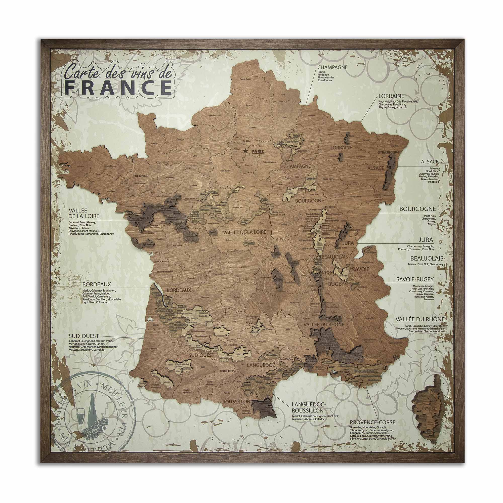
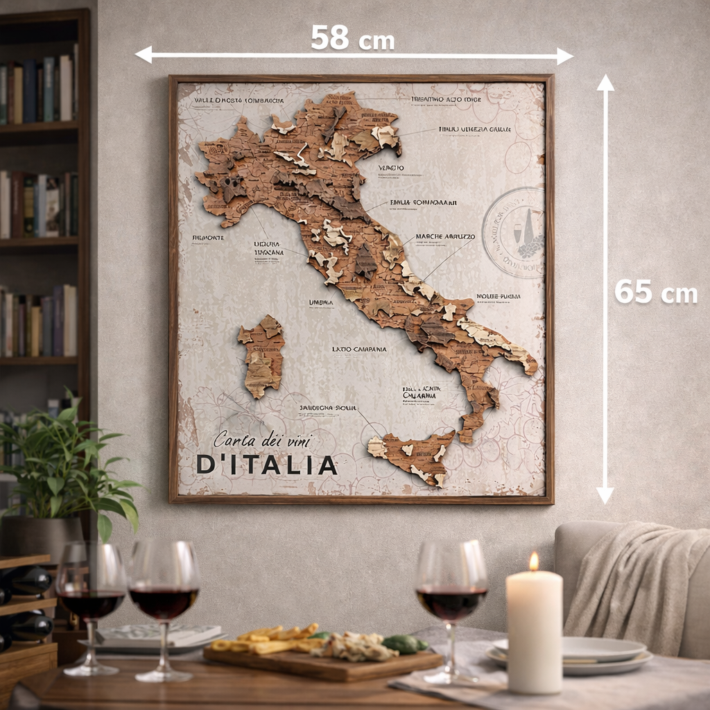
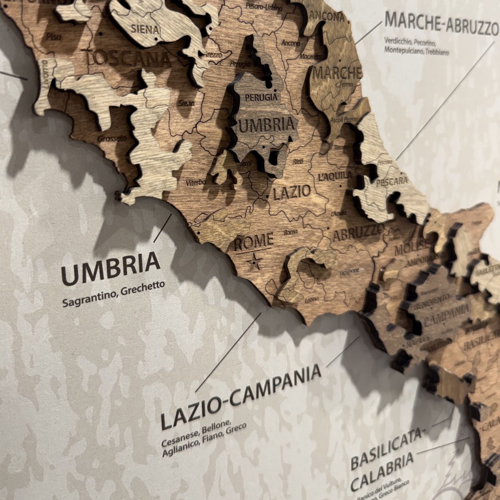
The panel arrives framed and assembled: Italy cut in wood and raised on a printed chart that names the regions in pairs with their grape varieties – Liguria-Toscana, Marche-Abruzzo, Sardegna-Sicilia – under the title Carta dei vini d'Italia. It hangs from the fixing built into the back in a few minutes and reads as a framed picture among other framed pictures.
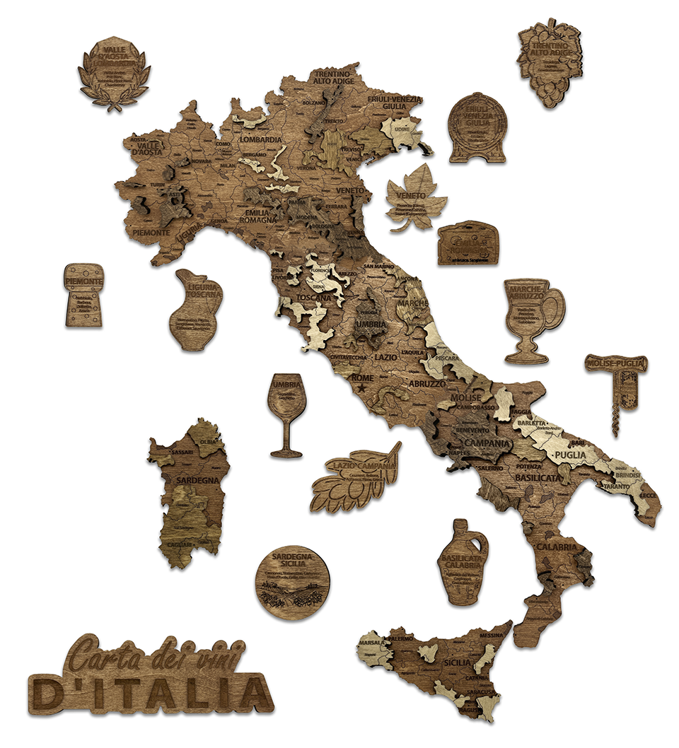
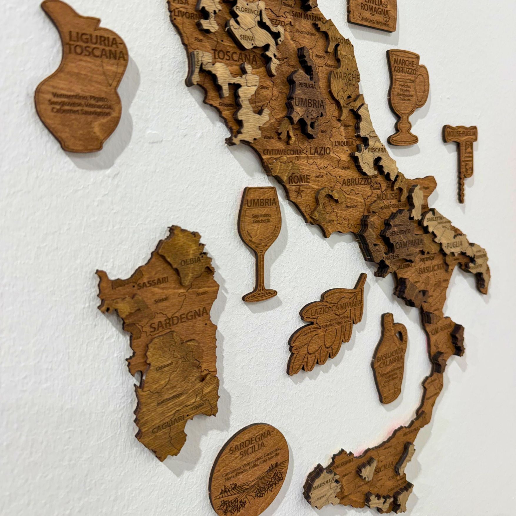
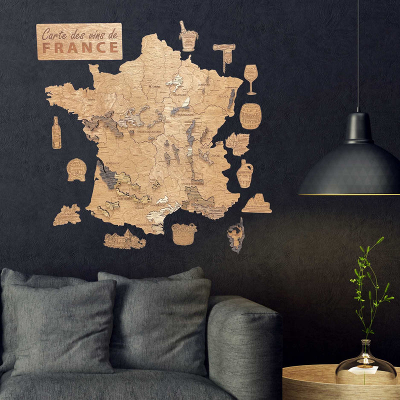
The wooden map has no chart at all. The peninsula, Sardinia and Sicily are mounted straight onto the wall, and around them go thirteen badges shaped like the tools of the trade – a laurel wreath, a cork, a jug, a bunch of grapes, a barrel, a vine leaf, a wedge of cheese, a goblet, a glass, a leafy branch, a corkscrew, an amphora and a round vineyard scene – each engraved with one or two regions and their grapes, so that all twenty appear. A wooden title plaque comes with them.
Panel for a busy room. Wooden for a plain wall that can carry an object.
Why does the shape work in its favour?
Italy is long and narrow, which makes it one of the most recognisable outlines there is and readable from further away than a compact country. On a wall it identifies itself instantly, and the region badges are what reward walking up to it.
Who buys them?
People whose interest in wine runs through Italy specifically – a different buyer from the French wine maps, not a lesser one. Barolo, Chianti, Amarone, Etna: the person who has learned those names wants to see the regions they come from laid out side by side.
It also works as a gift for someone who has travelled Italy without collecting its wines. The regions are the ones on the road signs as much as on the labels.
Where does each one hang?
The panel is 58 × 65 cm and occupies exactly what you see. The wooden map is 55 × 60 cm for the peninsula alone, and the badges spread outward from it as far as you choose to place them – lay the arrangement out on the floor before any tape goes on.
What these maps are not
Decorative rather than authoritative. DOC and DOCG designations are grouped into their regions rather than drawn separately, and boundaries are simplified to what can be cut and read at this scale.